
A Changing Himalaya: The Scientific Warning Behind the Rasuwa Disaster
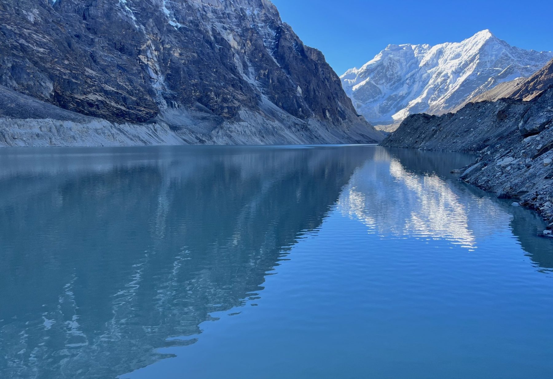
The Himalayan region of Nepal is one of the world’s most environmentally and geologically sensitive mountain systems. In recent years, accelerating glacier loss, the formation and expansion of glacial lakes, ice and rock avalanches, landslides, and sudden high-energy floods have demonstrated that changes in the Himalaya are no longer simply projections for the distant future. They are already unfolding. The 2024 flood in Thame, Solukhumbu, and the more recent disasters in the Bhotekoshi, Rasuwa region should not automatically be attributed to exactly the same physical mechanism. Yet they share an important scientific context: a rapidly changing Himalayan cryosphere, the interconnected system of glaciers, snow, ice, glacial lakes, and frozen or seasonally frozen terrain.
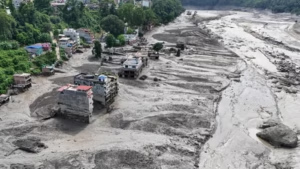
The precise mechanism behind the latest Rasuwa–Bhotekoshi disaster requires careful scientific investigation. It would therefore be premature to describe it conclusively as a conventional Glacial Lake Outburst Flood, or GLOF. Preliminary satellite observations and geographical analyses point to the possibility that a large mass of glacier ice, snow, rock, or a combination of these materials collapsed in the high mountains and entered the drainage system, generating an extremely powerful flow carrying water, sediment, rocks, and debris. This distinction is important because it demonstrates that the growing hazard in the Himalaya is not limited to glacial lakes suddenly bursting.
Understanding the changing Himalaya requires understanding the relationship between rising temperatures, glaciers, water, and mountain stability. As temperatures rise, glaciers do not simply melt. Their geometry changes, they retreat, and the surrounding landscape adjusts. Slopes that may once have been partly supported by glacier ice can become increasingly exposed and unstable. Changes in frozen ground can further weaken rock masses and steep mountain slopes. Under the right conditions, ice, snow, or rock can collapse, enter a lake or river, temporarily block a channel, displace enormous quantities of water, or create an unstable natural dam. If that blockage subsequently fails, a destructive mixture of water, mud, sediment, and boulders can surge downstream.
Scientists describe such processes as cascading hazards, one physical event triggering another, which then triggers another. A rockfall or avalanche, for example, can enter a glacial lake, produce a displacement wave, damage a moraine dam, release water, entrain sediment and rock, and eventually transform into a devastating debris flow downstream. This means that a disaster observed hundreds of kilometers downstream may have begun as a very different physical process high in the mountains.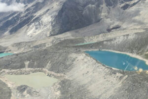
The 2024 Thame flood demonstrated this complexity. Subsequent scientific investigation indicated that the event involved a chain of processes rather than simply a large glacial lake spontaneously bursting. A major rock avalanche entered a lake and generated a displacement wave, contributing to a cascading release of water and debris. Such findings are important because they show that assessing Himalayan risk solely according to the size of a glacial lake is no longer sufficient. Scientists must also consider unstable slopes above lakes, glacier retreat, avalanche pathways, moraine stability, drainage systems, and the downstream landscape.
A major ICIMOD–UNDP assessment published in 2020 identified 3,624 glacial lakes of at least 0.003 square kilometers across the Koshi, Gandaki, and Karnali river basins spanning Nepal, China’s Tibet Autonomous Region, and India. Of these, 47 were classified as potentially dangerous glacial lakes. Twenty-one were located in Nepal, 25 in the Tibet Autonomous Region of China, and one in India. Particularly significant for Nepal is that 42 of those 47 potentially dangerous lakes were located within the Koshi basin.
However, the number 47 should not be interpreted as a permanent list of every glacial threat facing Nepal. It represents an assessment based on satellite imagery and scientific criteria available at a particular time. The Himalayan landscape is dynamic. New lakes can form, small lakes can expand, existing lakes can shrink or merge, glaciers can retreat, and surrounding slopes can become unstable. A lake that was relatively insignificant when one inventory was prepared may become more important years later. For this reason, Himalayan hazard maps must be treated as continuously evolving scientific tools rather than static documents.
Broader research on the Hindu Kush Himalaya also shows that glacier loss is accelerating. ICIMOD’s major 2023 assessment found that glaciers in the region disappeared about 65 percent faster during 2011–2020 than during the previous decade. This does not mean that every Himalayan glacier is melting at the same rate, nor does it mean that every glacial lake is about to burst. It does, however, reveal a clear long-term trend: the frozen environment of the Hindu Kush Himalaya is undergoing rapid transformation.
The consequences are more complicated than simply “more melting means more floods.” Glacier retreat can contribute to the formation and expansion of glacial lakes, but it can also alter drainage systems and the physical stability of surrounding terrain. Changes in snow, ice, frozen ground, precipitation, and extreme weather can interact with steep topography and active geology. Himalayan disaster risk therefore emerges from the interaction of climate, glaciers, lakes, rock, rainfall, rivers, and terrain rather than from any single factor.
Natural hazards may originate high in the mountains, but whether they become major human disasters also depends on what lies downstream. Settlements, roads, bridges, hydropower projects, markets, hotels, and other infrastructure have increasingly developed along Himalayan river corridors. A large flood passing through an uninhabited valley may remain primarily a natural event. The same flood passing through densely populated settlements and critical infrastructure can become a national catastrophe. Disaster risk is therefore determined not only by the magnitude of a natural hazard but also by exposure, vulnerability, land-use decisions, infrastructure design, and preparedness.
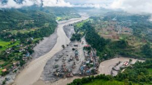
Rivers such as the Bhotekoshi, Sunkoshi, Arun, Dudhkoshi, and Trishuli present an additional challenge because of their steep gradients. A high-energy flood originating in the mountains can travel rapidly downstream while collecting additional water, sediment, trees, and boulders. Communities may have very little time to react. An effective warning system must therefore do more than transmit information to government offices. It must be capable of rapidly reaching settlements, schools, markets, hotels, hydropower facilities, local governments, police posts, and other vulnerable locations along the river corridor.
The transboundary nature of Himalayan rivers adds another layer of complexity. Glaciers, glacial lakes, landslides, and rivers do not follow political boundaries. The headwaters of several major rivers flowing through Nepal originate on the Tibetan Plateau. A lake failure, glacier collapse, landslide, or river blockage occurring north of the international border can therefore create consequences downstream in Nepal. The fact that 25 of the 47 potentially dangerous glacial lakes identified in the 2020 assessment were located in the Tibet Autonomous Region illustrates the importance of cross-border risk management.
For Nepal, this means that cooperation with China on hydrological and cryospheric information is not simply a matter of scientific interest; it is a matter of public safety. Satellite observations, river levels, extreme rainfall, unusual glacier movement, glacial lake changes, landslides, temporary river blockages, and sudden upstream flows should, wherever technically and diplomatically possible, be shared rapidly between the two countries. In a steep Himalayan river system, even a relatively short delay in receiving upstream information can significantly reduce the time available for evacuation downstream.
Nepal’s approach to Himalayan hazards must therefore move beyond the question, “Which glacial lake might burst?” A modern risk-monitoring system must ask a much broader set of questions. How rapidly are individual glaciers retreating? Where are new lakes forming? Which lakes are expanding? Which rock slopes above glaciers and lakes are becoming unstable? Where could an ice-rock avalanche occur? Where could a landslide temporarily block a river? If such a natural dam failed, how large would the resulting flood be, and how long would it take to reach downstream communities?
Answering these questions requires continuous satellite monitoring, remote sensing, field observations, automated high-altitude instruments, real-time river gauges, seismic and slope monitoring, regularly updated hazard maps, and effective community-based early-warning systems. Advances in satellite technology make it increasingly possible to detect changes in glaciers, lakes, and mountain slopes that would have been extremely difficult to monitor only a few decades ago. Nepal should use these technologies as part of a permanent national Himalayan hazard-monitoring system rather than primarily after disasters occur.
Technology alone, however, cannot save lives. An early warning is useful only when people know what to do with it. Communities must know where to evacuate, which routes are safe, how much time they may have, and how children, older people, people with disabilities, and visitors will be assisted. Schools, hotels, hydropower projects, border facilities, municipalities, and communities located along high-risk river corridors need practical emergency plans and regular drills. The purpose of modern disaster management should not merely be to rescue people after destruction has occurred, but to move people out of danger before the destructive flow reaches them whenever warning is possible.
Climate change forms an important part of this broader picture. Nepal contributes only a very small fraction of global greenhouse-gas emissions, yet its geography makes it highly vulnerable to the consequences of a warming planet. At the same time, scientific accuracy requires caution. It is not appropriate to attribute every individual flood, landslide, or glacier-related disaster directly to climate change without specific analysis. Climate change can alter the background conditions under which these hazards develop by accelerating glacier loss, changing snow and rainfall patterns, affecting frozen ground, influencing glacial lake development, and altering high-mountain stability. Determining exactly why a particular disaster occurred, however, requires event-specific evidence from satellite observations, meteorological records, topographic change, hydrology, and geological investigation.
The Thame flood and the latest Rasuwa–Bhotekoshi disaster may not have been identical events, but together they deliver a clear warning: the Himalaya is changing rapidly. Glaciers are retreating, glacial lakes are evolving, ice and rock stability is changing, and a disturbance originating high in the mountains can initiate a chain of events capable of producing devastating consequences far downstream.
For this reason, describing Himalayan glacial lakes simply as “natural bombs” may capture public fear, but it does not adequately represent the science. The greater challenge is a rapidly changing and interconnected mountain system in which glaciers, lakes, unstable slopes, rivers, extreme weather, infrastructure, and human settlements interact with one another.
The central question for Nepal is therefore no longer whether another high-mountain disaster will occur. Natural hazards have always been part of the Himalayan environment and will continue to occur. The more important question is whether Nepal will be scientifically, technologically, institutionally, and socially prepared when the next one comes. Can a dangerous change high in the mountains be detected early? Can that information cross an international border quickly when necessary? Can a warning reach communities downstream within minutes? Can land-use planning keep critical infrastructure away from the most dangerous corridors? And can people evacuate before a natural hazard becomes a mass-casualty disaster?
Nepal cannot stop the Himalaya from changing, nor can it address global climate change alone. But it can significantly reduce the human consequences through science, continuous monitoring, responsible development, international cooperation, effective early-warning systems, and community preparedness. That may ultimately be the most important scientific lesson emerging from the devastation in Rasuwa: we cannot eliminate the natural hazards of a changing Himalaya, but knowledge and preparedness can prevent many of those hazards from becoming human catastrophes.


United Sherpa Association Transfers $30,521 to Nepal’s Prime Minister’s Disaster Relief Fund
1 week ago
Global Sherpa Conference 2026: A Global Gathering to Preserve Heritage, Identity and Unity
2 weeks ago